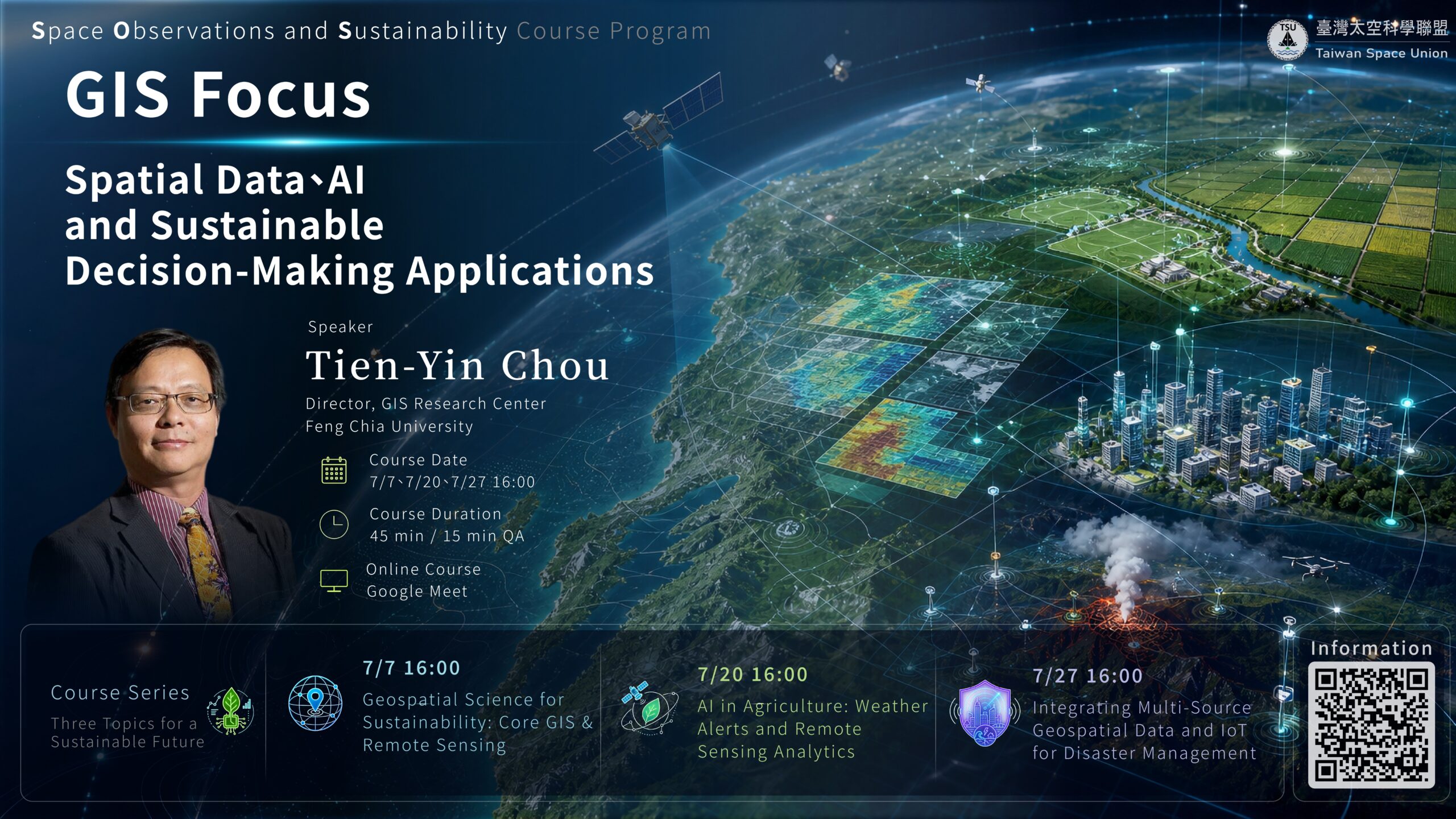
Space Observations and Sustainability Course Program
GIS, remote sensing, AI, and multi-source spatial data for sustainable decision-making.
The Space Observations and Sustainability Course Program introduces key concepts and practical applications of geospatial technologies for sustainable development. The series highlights how GIS, remote sensing, AI, and multi-source spatial data can be transformed into actionable information for environmental monitoring, smart agriculture, disaster management, and sustainable decision-making.
Tien-Yin Chou
Director, GIS Research Center
Feng Chia University
Dean Tien-Yin Chou is the Director of the GIS Research Center at Feng Chia University. His expertise includes geographic information systems, remote sensing, geospatial data integration, and spatial decision support for sustainable development.
Three Topics for a Sustainable Future
GIS Foundations and Sustainable Development
Core GIS & Remote Sensing
This course delivers a refined introduction to the core frameworks of GIS and Remote Sensing (RS). We will focus on integrating multi-source geospatial data into actionable spatiotemporal big data, providing crucial scientific evidence and decision support for global environmental change and sustainable development.
Smart Agriculture and AI Applications
Weather Alerts and Remote Sensing Analytics
This course explores practical applications of spatial informatics in agriculture, utilizing microclimate data for weather alerts, analyzing agribusiness big data for decision-making, and applying AI deep learning to satellite imagery for automated crop identification.
Smart Cities, Rural Areas, and Disaster Management
and IoT for Disaster Management
This course focuses on multi-source data integration and real-time disaster prevention for smart habitats. Topics cover leveraging Internet of Things (IoT) technology with GIS data, establishing real-time monitoring mechanisms to provide precise decision support for disaster mitigation.
Registration Now Open
Please complete the registration form to attend the full course series. The Google Meet link will be sent to registered participants before the course.
Register Now